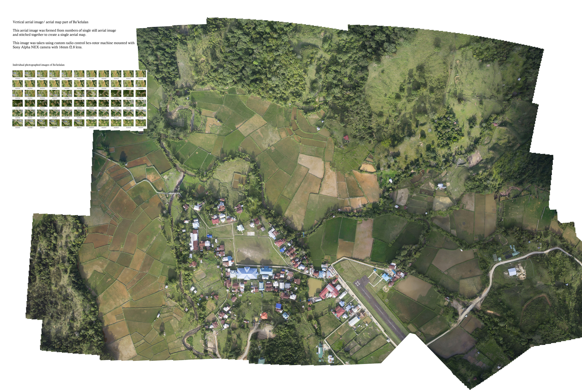
Aerial Photography for Mapping in Ba'kelalan (Poster)
A poster exhibited at UNIMAS R&D Expo
| Main Author: | |
|---|---|
| Format: | |
| Language: | English |
| Published: |
Universiti Malaysia Sarawak, (UNIMAS)
2015
|
| Subjects: | |
| Online Access: | http://ir.unimas.my/id/eprint/8658/ http://ir.unimas.my/id/eprint/8658/1/%5BPOSTER%5D%20UNIMAS%20R%26D%20Expo-1.jpg |